Showing posts with label Colorado Plateau. Show all posts
Showing posts with label Colorado Plateau. Show all posts
Thursday, January 24, 2013
Exploring A Grand Mystery
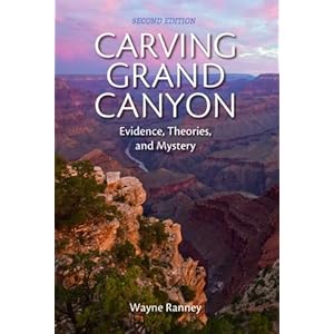
Carving Grand Canyon: Evidence, Theory, and Mystery,
by Wayne Ranney, is the next logical book to read after the one he
co-wrote with Ron Blakey, Ancient Landscapes of the Colorado Plateau. In Ancient
Landscapes, the authors describe
the environments in which the layers of the Colorado Plateau formed
and illustrate those concepts with paleogeographic maps. As you
study those maps, you can't help but try to impose the Grand Canyon
on them, since it's the feature that best exposes the layers. At
what point, you may wonder, does
the canyon begin to be carved?
Carving
Grand Canyon is the best answer
to that question. It narrates the attempt by geologists to
formulate a unified theory of how the Grand Canyon formed and how
long it took to do so. Once you've started reading it you'll realize
that theory is – complicated.
Fortunately,
it's also fascinating – a story of rivers and basins, faults and
frost wedging, lava flows and karst collapse, personalities and plate
tectonics. If you look at a map of the Canyon, from Lee's Ferry to
Grand Wash Cliffs, you may suspect that it's not simply a question of
how old the Colorado River is (though that's the most pertinent
question). It's a question of what else can happen in a region that
large, over millions of years during which several unique conditions
persist.
One
of the most interesting controversies is whether a paleocanyon may
have existed, one that continued to be cut down to current levels in
parts of the Grand Canyon. The graphic on page 124 beautifully
illustrates the argument that a paleocanyon existed in Mesozoic
layers above Eastern Grand Canyon that have since eroded away. The
relatively new study of karst collapse near the Kaibab Upwarp also
sheds some light on the mystery of how the river cut through the
southern tip of the upwarp.
This
book is for people whose curiosity burns when they look at the Grand
Canyon, trained geologists and armchair geologists alike. It is
lavishly illustrated with photographs, cross-sections, maps (some of
which are paleogeographic), and diagrams that make the text clear and
easy to understand. It offers a coherent answer to a question that
is far more complicated than it seems. And best of all, it sparks as
much curiosity as it satisfies. Buy two copies – one for your
reference library, and one to take with you as you explore Grand
Canyon, a place with enough wonder to fill a lifetime.
Friday, December 7, 2012
Wayne Ranney: Geologist, Adventurer, and Mapmaster Flash
You
may recall that I mentioned, sometime in the recent past, the
paleogeographic maps are fabulous. Or you may not. But they are.
And what's even more wonderful is that Wayne Ranney, one of the guys
behind those afore-mentioned fabulous maps will be speaking at the
Heard Museum on Tuesday, December 11, at 1:30 p.m. To 3:00 p.m.
He'll be signing copies of his books in our book store afterward.
I've posted a review of the book he co-wrote with Ron Blakey, Ancient Landscapes of the Colorado Plateau,
which features maps that depict what the Colorado Plateau may have
looked like millions and even billions of years ago.
I will soon be
posting a review of Carving Grand Canyon: Evidence, Theories, and Mystery (2nd Edition) which casts light on past and recent arguments about when the Grand
Canyon began to form.
And I look forward to diving into Sedona
Through Time, which delves into
the formation of one of the most beautiful places on Earth: Oak Creek
Canyon.
We have all three titles available at the Heard Museum Book
Store, and Mr. Ranney will be signing there after his lecture. Don't
miss it!
Thursday, November 1, 2012
Paleogeographic Maps Are Fabulous
Think
of the nerdiest comic book fan drooling over his favorite graphic
novel - that's how I look when I have this book in my hands. As a
geology student who lives in Arizona, I have good reason to be such a
geek. Every time I visit the Colorado Plateau, I have a thousand
questions about how the strata formed. This book answers most of
those questions, and illustrates those answers beautifully with
diagrams, cross-section charts, photographs, and "paleogeographic
maps." Those maps allow the reader to see what the area may have
looked like in the past, from the last part of the Precambrian Era,
1.7 billion years ago, through the Mesozoic with its dinosaurs, to
the the Cenozoic and our present epoch. If you've ever tried to
visualize the supercontinents, or what the Four Corners area may have
looked like when it was turned on its side and hugging the equator,
the paleogeographic maps are hugely helpful.
Readers
who are more interested in archaeology will gain some perspective as
to why the ruins in the Southwest are unique - we've got the perfect
strata for canyons, creeks, and cliff dwellings. And anyone who would
like more background on the geology of their favorite National Park
on the Colorado Plateau will find this book handy. As for me, I'm a
happy geek pouring over the details of how each layer was formed and
where it's exposed in this landscape I love so much. I will refer to
this book again again, until it falls apart and I have to get another
one. It's money well spent.
Subscribe to:
Posts (Atom)


