Fascinating courtly intrigue and bloody power games set on a generation ship full of secrets―Medusa Uploaded is an imaginative, intense mystery about family dramas and ancient technologies whose influence reverberates across the stars. Disturbing, exciting, and frankly kind of mind-blowing.” ―Annalee Newitz, author of Autonomous

Showing posts with label Oak Creek Canyon. Show all posts

Monday, February 25, 2013

Sedona Through Time


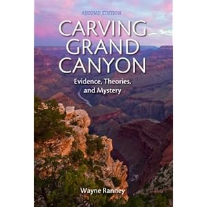
Sedona Through Time (3rd edition), by Wayne Ranney, is the third book in what I like to call Ranney's Rock Trilogy. Book One, Ancient Landscapes Of The Colorado Plateau (co-written with Ron Blakey), takes us step-by-step through the landscape changes in the Four Corners area, beautifully illustrating each geologic occurrence with Paleogeographic maps. Book Two, Carving Grand Canyon, zooms in on the most breathtaking landform in North America, delving into a lesser-known feature called the Mogollon Highlands, which turns out to be one of the major forces in the formation of the Grand Canyon and of Sedona, the focus of Book Three.

By the time you read Sedona Through Time, you've got a much better idea of how the layers in Sedona formed, because they are many of the same layers present in the Grand Canyon. But once you go Southeast to Sedona, those layers have changed a bit in character, and some unique features appear, like the Schnebly Hill Formation. The helpful diagrams, maps, and photographs that are present in Books One & Two of Ranney's Rock Trilogy are also present in Book Three, and they are very effective in illustrating the geologic events that created Sedona.

Anyone who visits Sedona and nearby Oak Creek Canyon is struck by their beauty and serenity. They possess a profound spirit that is as beautiful as what you can experience in the Grand Canyon, but is much more up-close and personal. Having some knowledge of what the rocks are and how they got there enhances that experience. For visitors whose curiosity is piqued, the book also includes a point-by-point road and trail guide. So take it with you when you visit – you'll see Sedona and Oak Creek Canyon as you've never seen them before.   

Friday, December 7, 2012

Wayne Ranney: Geologist, Adventurer, and Mapmaster Flash


You may recall that I mentioned, sometime in the recent past, the paleogeographic maps are fabulous. Or you may not. But they are. And what's even more wonderful is that Wayne Ranney, one of the guys behind those afore-mentioned fabulous maps will be speaking at the Heard Museum on Tuesday, December 11, at 1:30 p.m. To 3:00 p.m. He'll be signing copies of his books in our book store afterward. I've posted a review of the book he co-wrote with Ron Blakey, Ancient Landscapes of the Colorado Plateau, which features maps that depict what the Colorado Plateau may have looked like millions and even billions of years ago.


 I will soon be posting a review of Carving Grand Canyon: Evidence, Theories, and Mystery (2nd Edition) which casts light on past and recent arguments about when the Grand Canyon began to form.


 And I look forward to diving into Sedona Through Time, which delves into the formation of one of the most beautiful places on Earth: Oak Creek Canyon.


We have all three titles available at the Heard Museum Book Store, and Mr. Ranney will be signing there after his lecture. Don't miss it!

Thursday, November 1, 2012

Paleogeographic Maps Are Fabulous


Think of the nerdiest comic book fan drooling over his favorite graphic novel - that's how I look when I have this book in my hands. As a geology student who lives in Arizona, I have good reason to be such a geek. Every time I visit the Colorado Plateau, I have a thousand questions about how the strata formed. This book answers most of those questions, and illustrates those answers beautifully with diagrams, cross-section charts, photographs, and "paleogeographic maps." Those maps allow the reader to see what the area may have looked like in the past, from the last part of the Precambrian Era, 1.7 billion years ago, through the Mesozoic with its dinosaurs, to the the Cenozoic and our present epoch. If you've ever tried to visualize the supercontinents, or what the Four Corners area may have looked like when it was turned on its side and hugging the equator, the paleogeographic maps are hugely helpful.

Readers who are more interested in archaeology will gain some perspective as to why the ruins in the Southwest are unique - we've got the perfect strata for canyons, creeks, and cliff dwellings. And anyone who would like more background on the geology of their favorite National Park on the Colorado Plateau will find this book handy. As for me, I'm a happy geek pouring over the details of how each layer was formed and where it's exposed in this landscape I love so much. I will refer to this book again again, until it falls apart and I have to get another one. It's money well spent.

Wednesday, May 30, 2012

Oak Creek Canyon, Vortex Of Fabulosity


As Ernie and I drove south toward Sedona on HWY 89, I mused about all of the years I've been visiting that spot. No doubt about it – Sedona, in its pre-vortex, pre-nouveau-riche, semi-old-west-town incarnation was a lot more fun than it is now. But Oak Creek Canyon, Sedona's raison d'etre, remains beautiful, magical, and delightful. There is no place like it on Earth, and the not-so-simple reason for that is its geology.


It's a small canyon – at least, compared to its giant cousin up North. Yet it shares a lot of the same layers you see exposed in the Grand Canyon. The mnemonic to remember with that chunk of the Colorado Plateau is this one: Know The Canyon's History – Study Rocks That're Made By Time.

Know – Kaibab: sandy limestone, greyish-white
The – Toroweap: also sandy limestone, a bit darker
Canyon's – Coconino: cross-bedded sandstone
History – Hermit: shale
Study – Supai: it's complicated
Rocks – Redwall: limestone (gray, but stained red by      hematite)
That're – Temple Butte: sandy dolomite, sandstone, mudstone, and limestone
Made – Muav: limestone
By – Bright Angel: shale
Time – Tapeats: sandstone


All of those layers, starting with the Tapeats at the bottom and ending with the Kaibab on top, are Paleozoic. In Northern and Eastern Arizona you can find at least a few Mesozoic layers too (from the Age of Dinosaurs): Moenkopi, Moenavi, the Chinle layer of Petrified Forest National Park, the Navajo Sandstone of Monument Valley, etc. It gets complicated, depending on how far North and East you go. Arizona was at the edge of the continent when a lot of this stuff formed, so you see layers from shallow seas, sandy shores, dune-y deserts, and river floodplains.


Ernie and I observed the whimsical shapes into which the Moenkopi layer likes to erode when we hiked through Wupatki. If we had continued North on HWY 89 (or the equally delightful alternate route, 89A) we would have seen more of this layer in Utah. Heading South on 89, we dropped in elevation, losing any hint of the dinosaur age, but discovering some interesting layers in Oak Creek Canyon that are not seen in the Grand Canyon. The east side of the fault that forms Oak Creek Canyon is topped by a thick basalt layer, a lava flow. But the Kaibab, Toroweap, and Coconino layers were eroded on this side of the fault, so the layer under that is the Hermit.


Much of the west side (1000 feet higher than the east) is topped with the Kaibab limestone. The basement rock is the Redwall layer – a lot of Sedona is built on that layer. Above that is the Supai, which is actually a group of layers, mostly sandstone and mudstone. The Hermit shale layer sits on top of that; despite its name, it is a complicated mix of sandstone, mudstone, and conglomerate. And on top of that is an 800 to 1000-foot-thick layer unique to the area: the Schnebly Hill formation, a series of gold and rust-red layers of sandstone, mudstone, and limestone. The sandy parts were were once coastal dunes.


Another layer pinches out inside the Schnebly Hill formation, a greyish band of Fort Apache Limestone. Coconino sandstone tops many of the formations on the south side, but it merges in places with the Schnebly Hill formation, giving the rocks a nifty striped appearance.


Like the Grand Canyon, Oak Creek Canyon can surprise you as it suddenly appears out of the landscape. This is particularly true if you approach from Flagstaff. The North end of the canyon is hidden among trees. Then you get to drive down the niftiest switchbacks on Earth, observing some spots where the layers have literally been pulverized by the fault. Invariably, when I'm driving through oak Creek Canyon, I have to pull over to let impatient motorists pass. For some reason, they like to zoom through this paradise, as if they could actually be bored by the sight. Poor, doomed souls. I hope my spirit will take this route to the Great Beyond, once I've left this mortal form behind.


In the meantime, this mortal form is very happy to hike various spots in the canyon (after having eaten a delightful lunch at the Galaxy Diner in Flagstaff). The first spot I wanted to hit was the trail near the West Fork of the Creek. You have to pay to get into this spot – it's not a State Park or a National Park. But it deserves to get a little moolah for its upkeep, and I'm grateful it never draws the same sort of crowd you would see at Slide Rock State Park. (Try visiting Slide Rock in January if you just want to hike and don't care about swimming – hardly anyone is there and it's spectacular.)


After that, we headed for Midgely Bridge (or as the locals call it, Midgely Bridgely). The climb down to the trail that begins under the bridge is a little heart-stopping, but you get an amazing view of the fork in the creek and of the Supai rocks. You can hike all the way down to the creek from there, a hot proposition if it's summer and the sun is shining. Fortunately for us, it was a cloudy spring day, so down we went. Wildflowers and rock formations caught my eye on the way down, and I saw some evidence of ancient hot spring activity in some of the rocks that had eroded from higher spots.


Hiking back up was much more of a challenge (for me, at least – Ernie is a mountain goat), but we still had enough energy to explore a part of the road (now a trail blocked to motor traffic) where the old bridge used to be. It was mysterious, and hinted at other spots not often accessed by casual hikers in the canyon. Some day, Ernie and I will spend a season there, exploring the general area. This is my fond ambition . . .


But the day was waning, so we stopped at our favorite coffee joint on HWY 89, before looping back to do the spectacular drive along HWY 179. Some of the niftiest formations reside there, and at one point the setting sun set the rocks ablaze. I had to pull over to one of the overlooks and snap some photos. I just managed to catch the sunset lighting up the rocks before the light shifted and the moment passed. My heart brimmed with satisfaction.


Sipping iced mochas, we headed back to Phoenix on I-17. I would rather have lingered and extended our day trip into days, weeks, months. But I comfort myself by considering the fact that Oak Creek Canyon, Walnut Canyon, Sunset Crater, Wupatki, Montezuma Castle, and dozens of other wonderful spots are in my backyard.


I just need to venture there from time to time.

Friday, July 22, 2011

Red Rocks, Rain, Haboobs, and Happiness


Our new work schedules have made it difficult for Ernie and me to do day trips together, but last Monday was an exception. We're not ones to waste an opportunity like that, so we piled into our truck and drove North to Oak Creek Canyon. Here's a link to Ernie's blog about our day. He did nifty sketches and everything.


We hiked on a path I'd never taken before, along Highway 179, in hot sunshine. By early afternoon, it was raining on us, and we got splashed with red mud. It rained on us most of the way home, but we finally hit a dry patch outside Black Canyon City. We rolled down our windows to dry off.


By the time we were driving South On I-17, into Phoenix, we saw a massive haboob rolling in. All in all, it was a fabulous day . . .

Thursday, January 20, 2011

Weird And Wonderful Arizona


If you've never been to Arizona, you're missing one of the wonders of the world. Plenty of other places are beautiful. Plenty of other places have history, or political power, or cultural significance. But Arizona is a unique collection of oddities and wonders that you won't find anywhere else.


This isn't something you would necessarily believe if you only visited Phoenix. Not if you've never been to the
Desert Botanical Garden, or the Heard Museum – not if you feel beauty is only solid green and humid. I admit, it's easier to appreciate Arizona if you like geology, lightning, birds, and giant, columnar cacti. You may think you'll only see desert vistas here if you don't know that our highest peak is around 12,600 feet and that we have snowy, forested mountains as well as deep, dry basins.

But I admit our reputation as a desert state is well-earned. All four of the great deserts of North America dangle their toes into Arizona. To the North is the Great Basin Desert, spilling over our border from Utah and Nevada – it's a rain-shadow desert full of scrubby sage-brush. In the North-West is the Mojave, whose most famous feature is Death Valley, another Wonder of the World – its signature plant is the Joshua Tree. From the South-East, the Chihuahuan Desert spills into Texas, New Mexico, and the South-Eastern basins of Arizona – it harbors shrubs and small, tough cacti. But the biggest desert in Arizona is the Sonoran, in the South and South-West. It's the only place in the world that has two rainy seasons. And the Sonoran is the American desert with the warmest winter. That's why we're the only place in the world where the Saguaro grows.


Stand alone in the open desert among a group of saguaros, and you won't feel alone. They live between 100 and 200 years, and they have a presence. Think of them as the Ents of the desert. They can be a scruffy lot, and they often make faces at people. Some of them look more dead than alive. But some of them top 50 feet, and one famous guy has over 100 arms.


Arizona is Geology Heaven, a place where the rocks aren't “haired over” by vegetation. We have a long, varied volcanic history, starting about 1.7 billion years ago when our chunk of North America plowed into the ancient Canadian Shield. The
Grand Canyon is unparalleled in its ability to represent millions of years of sediment laid down by shallow seas and by lakes, rivers, and even sand dunes. But Arizona is one, giant erosion feature – we have many other canyons. Oak Creek Canyon is an enchanted place with deep red sandstone. Walnut Canyon is carved from the same cross-bedded Coconino sandstone and Kaibab limestone found at the top of the Grand Canyon.


Despite decades of plundering by fools and yahoos, the
Petrified Forest features the best examples of petrified wood in the world. You can see petroglyphs on Newspaper Rock and near one of the preserved archaeological sites in the park. But my favorite thing about Petrified Forest is its bizarre Chinle layer, which doesn't quite look like any other sedimentary group I've ever seen. It's made up of shale, silt, mudstone, a little sand, and silica from volcanic ash. It's colors range from blue to red, pink, brown, green, yellow, tan – based on whatever trace elements are present.


We have a
meteor crater. We have a volcano that last erupted about 1000 years ago. We have more bird species than any other state in the union. We have thunderstorms that sound like atomic explosions. We have snowstorms AND sandstorms. We have the best Mexican food in the southwest (stop squawking, Texas and New Mexico – you know it's true). Navajos and Hopis own most of the North-East part of our state – a place that looks a lot like Mars. The Spaniards never successfully colonized us, thanks to the Apaches and their original Homeland Security. The coldest winter temperature on record for Phoenix was 16 degrees Fahrenheit – the hottest summer temperature was 123 degrees Fahrenheit.

And we're good-looking, too. Though we can be a scruffy lot. And some of us make faces at people.

If you're thinking of visiting, try all of those places I mentioned. You'll be amazed. But you'll barely scratch the surface of what's here. I've lived here over 50 years, and I'm still exploring. Sometimes I dream of visiting other places. Sometimes I even go. But I'm like the saguaro. This is the only place I can live.


Maybe if I live another 50 years, I'll even grow some more arms . . .